Showing posts with label mixed use development. Show all posts

Sunday, January 3, 2010

Smart Growth

Smart GrowthSmart growth is an urban planning and transportation theory that concentrates growth in the center of a city to avoid urban sprawl; and advocates compact, transit-oriented, walkable, bicycle-friendly land use, including neighborhood schools, complete streets, and mixed-use development with a range of housing choices.
Smart growth values long-range, regional considerations of sustainability over a short-term focus. Its goals are to achieve a unique sense of community and place; expand the range of transportation, employment, and housing choices; equitably distribute the costs and benefits of development; preserve and enhance natural and cultural resources; and promote public health.

Smart Growth Overview
In communities across the nation, there is a growing concern that current development patterns -- dominated by what some call "sprawl" -- are no longer in the long-term interest of our cities, existing suburbs, small towns, rural communities, or wilderness areas.

Though supportive of growth, communities are questioning the economic costs of abandoning infrastructure in the city, only to rebuild it further out. They are questioning the social costs of the mismatch between new employment locations in the suburbs and the available work-force in the city. They are questioning the wisdom of abandoning "brownfields" in older communities, eating up the open space and prime agricultural lands at the suburban fringe, and polluting the air of an entire region by driving farther to get places.

Spurring the smart growth movement are demographic shifts, a strong environmental ethic, increased fiscal concerns, and more nuanced views of growth. The result is both a new demand and a new opportunity for smart growth.
Smart growth recognizes connections between development and quality of life. It leverages new growth to improve the community. The features that distinguish smart growth in a community vary from place to place. In general, smart growth invests time, attention, and resources in restoring community and vitality to center cities and older suburbs. New smart growth is more town-centered, is transit and pedestrian oriented, and has a greater mix of housing, commercial and retail uses. It also preserves open space and many other environmental amenities.

But there is no "one-size-fits-all" solution. Successful communities do tend to have one thing in common--a vision of where they want to go and of what things they value in their community--and their plans for development reflect these values.
(Text from executive summary of Why Smart Growth: A Primer by International City/County Management Association with Geoff Anderson, 7/98.)
Principles of Smart Growth
  • Create a Range of Housing Opportunities and Choices-Providing quality housing for people of all income levels is an integral component in any smart growth strategy.
  • Create Walkable Neighborhoods- Walkable communities are desirable places to live, work, learn, worship and play, and therefore a key component of smart growth.
  • Encourage Community and Stakeholder Collaboration- Growth can create great places to live, work and play -- if it responds to a community’s own sense of how and where it wants to grow.
  • Foster Distinctive, Attractive Communities with a Strong Sense of Place- Smart growth encourages communities to craft a vision and set standards for development and construction which respond to community values of architectural beauty and distinctiveness, as well as expanded choices in housing and transportation.
  • Make Development Decisions Predictable, Fair and Cost Effective- For a community to be successful in implementing smart growth, it must be embraced by the private sector.
  • Mix Land Uses- Smart growth supports the integration of mixed land uses into communities as a critical component of achieving better places to live.
  • Preserve Open Space, Farmland, Natural Beauty and Critical Environmental Areas- Open space preservation supports smart growth goals by bolstering local economies, preserving critical environmental areas, improving our communities quality of life, and guiding new growth into existing communities.
  • Provide a Variety of Transportation Choices- Providing people with more choices in housing, shopping, communities, and transportation is a key aim of smart growth.
  • Strengthen and Direct Development Towards Existing Communities- Smart growth directs development towards existing communities already served by infrastructure, seeking to utilize the resources that existing neighborhoods offer, and conserve open space and irreplaceable natural resources on the urban fringe.
  • Take Advantage of Compact Building Design- Smart growth provides a means for communities to incorporate more compact building design as an alternative to conventional, land consumptive development.
Overview of Issue Areas
In addition to the many resource areas (bibliographies, documents, etc.) in the Smart Growth Network website, specific topics of smart growth are organized into 7 issue areas that each contain overviews and on-line resources. (Click on the issue area name to go to that page)
  • Community Quality of Life- Smart growth offers a framework to build community and help create and preserve a sense of place. It does this through housing and transportation choices, urban green spaces, recreational and cultural attractions, and policies and incentives that promote mixed-use neighborhoods.
  • Design- Smart growth creates communities that offer health, social, economic, and environmental benefits for all. It achieves this by promoting resource-efficient building and community designs, green building practices, low-impact development, and mixed-use and walkable neighborhoods.
  • Economics- Smart growth encourages community-based small business investment and development, adds to the variety of local employment opportunities, and helps attract new businesses and industries. More efficient government services are key to this, as are public and private investments that focus on quality of life improvements.
  • Environment- Many of our current environmental challenges — air and water pollution, global warming, habitat fragmentation and conversion — are due in part to the way we have built our neighborhoods, communities, and metropolitan areas during the past half-century.
  • Health- Smart growth reduces health threats from air and water pollution and indoor air contaminants through resource-efficient building design and offering transportation options such as mass transit, bike lanes, and pedestrian walkways. These engage residents and workers in a more active, healthy lifestyle.
  • Housing- Smart growth promotes housing options for diverse lifestyles and socio-economic levels. It does this through mixed-use, affordable housing and compact development that revitalizes neighborhoods and provides an alternative to automobile-dependent communities.
  • Transportation- Smart growth protects public health and environmental quality, conserves energy, and improves the quality of life in communities by promoting new transportation choices and transit-oriented development.
For more information on Smart Growth: Smart Growth in a Changing World by Jonathan Barnett, F. Kaid Benfield, Paul Farmer, Shelley Poticha, Robert Yaro, and Armando Carbonell, or visit SmartGrowth.org
Tuesday, October 6, 2009

Mixed Use Development

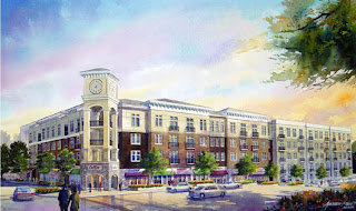
Mixed-use development is the practice of allowing more than one type of use in a building or set of buildings. In planning zone terms, this can mean some combination of residential, commercial, industrial, office, institutional, or other land uses.

Mixed-use development provides flexible, performance-based zoning standards. It allows residential uses integrated with commercial, employment, and civic uses in appropriate locations. Examples of this would be main streets, downtown areas, neighborhood centers, and other core places. Flexibility in the height of buildings, housing densities, lot coverages, yards being setback, landscaping, and other zoning provisions are all considered in mixed use developments. Where mixed-use development is permitted, codes should allow residential uses above or behind permitted commercial or civic uses, and the combination of compatible commercial uses (i.e. office, retail, entertainment, and services).

The idea behind Mixed use development is to also allow for small-scale commercial uses in residential neighborhoods thus allowing people to walk to nearby establishments for quick necessities, (i.e. a gallon of milk, a loaf of bread, etc) rather than having to drive to the store.

Commercial development is constantly reinventing itself. After relocating in strip-malls, commercial development is now returning to America’s downtowns and main streets. These areas are experiencing a renaissance, as people seek more intimate and pedestrian-friendly shopping experiences. Suburban commercial centers and corridors, too, are being transformed. Some big box stores are evolving into mixed-use centers with entertainment uses, and malls are turning themselves “inside-out,” using storefronts that mimic traditional downtowns. Cities are converting brownfields into urban villages with housing, retail, entertainment, and civic uses, and e-commerce is spawning small businesses in old warehouses and along main streets. All of these innovations pose opportunities and challenges for managing growth in our communities.

Principles of Mixed Use Development:
  • Efficient Use of Land Resources- Efficiency means urban development is compact and uses only as much land as is necessary.
  • Full Utilization of Urban Services- Use existing service capacity where available, and make the most of our infrastructure investments. Where needed size new facilities to meet the needs of the population.
  • Mixed Use- Mixed-use development brings compatible land uses closer together.
  • Transportation Options- Walking, Bicycling, Public Transit, and Private Transit are all included in ones transit options making communities more friendly and unified.
  • Human–Scale Design- Smart design is attractive design that is pedestrian–friendly and appropriate to community character and history. The objective is to design buildings to a human scale for aesthetic appeal, pedestrian comfort, and compatibility with other land uses.
Some of the benefits of Mixed Use Development are:
  • Economic development
  • Revitalization of main streets, downtowns, and neighborhood centers (reverting back to the city beautiful movement)
  • Development of needed housing close to jobs and services; and the creation of jobs close to where people live
  • Transportation choices and connectivity
  • Walkable communities and transit-supportive development, causing a decrease in commuter congestion
  • Energy conservation
Mixed Use Development is intended to bring order, clarity and a pleasing harmony to the urban places within the city; renewing the character, and feeling of community.

For complete information on Mixed Use Development practices: Mixed-Use Development Handbook by Dean Schwanke

Saturday, September 26, 2009

New Urbanism

New Urbanism is an urban design movement, which promotes walkable neighborhoods that contain a range of housing and job types. It arose in the United States in the early 1980s and continues to reform many aspects of real estate development and urban planning.

New Urbanism is strongly influenced by urban design standards prominent before the rise of the automobile and encompasses principles such as traditional neighborhood design (TND) and transit-oriented development (TOD). It is also closely related to Regionalism and Environmentalism.

The organizing body for New Urbanism is the Congress for the New Urbanism, founded in 1993. Its foundational text is the Charter of the New Urbanism, which says:

“We advocate the restructuring of public policy and development practices to support the following principles: neighborhoods should be diverse in use and population; communities should be designed for the pedestrian and transit as well as the car; cities and towns should be shaped by physically defined and universally accessible public spaces and community institutions; urban places should be framed by architecture and landscape design that celebrate local history, climate, ecology, and building practice.”

New urbanists support regional planning for open space, context-appropriate architecture and planning, and the balanced development of jobs and housing. They believe their strategies can reduce traffic congestion, increase the supply of affordable housing, and rein in urban sprawl. The Charter of the New Urbanism also covers issues such as historic preservation, safe streets, green building, and the redevelopment of brownfield land.

Until the mid 20th century, cities were generally organized into and developed around mixed-use walkable neighborhoods. For most of human history this meant a city that was entirely walkable, although with the development of mass transit the reach of the city extended outward along transit lines, allowing for the growth of new pedestrian communities such as streetcar suburbs. But with the advent of cheap automobiles and favorable government policies, attention began to shift away from cities and towards ways of growth more focused on the needs of the car.

This new system of development, with its rigorous separation of uses, became known as "conventional suburban development" or pejoratively as urban sprawl, arose after World War II. The majority of U.S. citizens now live in suburban communities built in the last fifty years, and automobile use per capita has soared.

In 1991, the Local Government Commission, a private nonprofit group in Sacramento, California, invited architects Peter Calthorpe, Michael Corbett, Andrés Duany, Elizabeth Moule, Elizabeth Plater-Zyberk, Stefanos Polyzoides, and Daniel Solomon to develop a set of community principles for land use planning. Named the Ahwahnee Principles (after Yosemite National Park's Ahwahnee Hotel), the commission presented the principles to about one hundred government officials in the fall of 1991, at its first Yosemite Conference for Local Elected Officials.

Calthorpe, Duany, Moule, Plater-Zyberk, Polyzoides, and Solomon founded the Chicago-based Congress for the New Urbanism in 1993. The CNU has grown to more than 3,000 members, and is the leading international organization promoting new urbanist design principles. It holds annual Congresses in various U.S. cities.

New Urbanism is a broad movement that spans a number of different disciplines and geographic scales. And while the conventional approach to growth remains dominant, New Urbanist principles have become increasingly influential in the fields of planning, architecture, and public policy.

The principles of New Urbanism are:

1. Walkability

  • Most things within a 10-minute walk of home and work
  • Pedestrian friendly street design (buildings close to street; porches, windows & doors; tree-lined streets; on street parking; hidden parking lots; garages in rear lane; narrow, slow speed streets)
  • Pedestrian streets free of cars in special cases

2. Connectivity

  • Interconnected street grid network disperses traffic & eases walking
  • A hierarchy of narrow streets, boulevards, and alleys
  • High quality pedestrian network and public realm makes walking pleasurable

3. Mixed-Use & Diversity

  • A mix of shops, offices, apartments, and homes on site. Mixed-use within neighborhoods, within blocks, and within buildings
  • Diversity of people - of ages, income levels, cultures, and races

4. Mixed Housing-

  • A range of types, sizes and prices in closer proximity (Duplexes, Small Lots, Condos, Townhouses, etc)

5. Quality Architecture & Urban Design

  • Emphasis on beauty, aesthetics, human comfort, and creating a sense of place; Special placement of civic uses and sites within community. Human scale architecture & beautiful surroundings nourish the human spirit

6. Traditional Neighborhood Structure

  • Discernable center and edge
  • Public space at center
  • Importance of quality public realm; public open space designed as civic art
  • Contains a range of uses and densities within 10-minute walk
  • Transect planning: Highest densities at town center; progressively less dense towards the edge. The transect is an analytical system that conceptualizes mutually reinforcing elements, creating a series of specific natural habitats and/or urban lifestyle settings. The Transect integrates environmental methodology for habitat assessment with zoning methodology for community design. The professional boundary between the natural and man-made disappears, enabling environmentalists to assess the design of the human habitat and the urbanists to support the viability of nature. This urban-to-rural transect hierarchy has appropriate building and street types for each area along the continuum.

7. Increased Density

  • More buildings, residences, shops, and services closer together for ease of walking, to enable a more efficient use of services and resources, and to create a more convenient, enjoyable place to live.
  • New Urbanism design principles are applied at the full range of densities from small towns, to large cities

8. Green Transportation

  • A network of high-quality trains connecting cities, towns, and neighborhoods together
  • Pedestrian-friendly design that encourages a greater use of bicycles, rollerblades, scooters, and walking as daily transportation

9. Sustainability

  • Minimal environmental impact of development and its operations
  • Eco-friendly technologies, respect for ecology and value of natural systems
  • Energy efficiency
  • Less use of finite fuels
  • More local production
  • More walking, less driving

10. Quality of Life

  • Taken together these add up to a high quality of life well worth living, and create places that enrich, uplift, and inspire the human spirit.
Click here for more information about New Urbanism: The New Urbanism: Toward an Architecture of Community by Peter Katz.

Friday, September 25, 2009

Brownfields

Brownfields are abandoned or underused industrial and commercial facilities available for re-use. Expansion or redevelopment of such a facility may be complicated by real or perceived environmental contaminations.

In the United States city planning jargon, Brownfield land (or simply a Brownfield) is land previously used for industrial purposes or certain commercial uses. The land may be contaminated by low concentrations of hazardous waste or pollution, and has the potential to be reused once it is cleaned up. Land that is more severely contaminated and has high concentrations of hazardous waste or pollution, such as a Superfund site, does not fall under the Brownfield classification. Mothballed Brownfields are properties which the owners are not willing to transfer or put to productive reuse.

The term brownfields first came into use on June 28, 1992, at a U.S Congressional field hearing hosted by the Northeast Midwest Congressional Coalition. Also in 1992, the first detailed policy analysis of the issue was convened by the Cuyahoga County Planning Commission. The United States Environmental Protection Agency selected Cuyahoga County as its first Brownfield pilot project in September 1993.

Generally, Brownfield sites exist in a city's or town's industrial section, on locations with abandoned factories or commercial buildings, or other previously polluting operations. Small brownfields also may be found in many older residential neighborhoods. For example, many dry cleaning establishments or gas stations produced high levels of subsurface contaminants during prior operations, and the land they occupy might sit idle for decades as a Brownfield.

Some state governments restrict development of Brownfield sites to particular uses in order to minimize exposure to leftover contaminants on-site after the cleanup is completed; such properties are deed-restricted in their future usage. Some legally require that such areas are reused for housing or for new commercial use in order not to destroy further arable land. The redevelopment of Brownfield sites is a significant part of new urbanism. Some brownfields are left as green spaces for recreational uses.

For historical reasons, many Brownfield sites are close to important thoroughfares such as highways and rivers; their reclamation can therefore be a major asset to a city. An example of this is the Atlantic Station project in Atlanta, the largest Brownfield redevelopment in the United States. In Seattle, rusted remains of a gas factory were left in place to add character to Gas Works Park.

But one of the most well-known areas in the United States for Brownfield redevelopment is Pittsburgh, Pennsylvania, which has successfully converted numerous former steel mill sites into high-end residential, shopping and offices. Several examples of Brownfield redevelopment in Pittsburgh include the following:
  • The Waterfront in Homestead, Pennsylvania previously occupied by Carnegie Steel
  • Summerset at Frick Park in Pittsburgh's Squirrel Hill neighborhood
  • Southside Works, a mixed-use development in the South Side neighborhood
  • Pittsburgh Technology Center in the Hazelwood (Pittsburgh) neighborhood
  • Washington’s Landing, a waterfront center for commerce, manufacturing, and housing in Herr's Island
For more information about Brownfield Regeneration: Sustainable Brownfield Regeneration: Liveable Places from Problem Spaces by Tim Dixon, Mike Raco, Philip Catney, and David N. Lerner.
 

Sustainability News

Check back for more news later

About

I just wanted to take a moment to send a personal message out to all those in the fields of Landscape Architecture, Gardening, Horticulture, and Urban Planning/Urban Ecology. I created Landscape Connections for the purpose to share my love and passion for Landscape Architecture and Design, and Urban Ecology. I was a Landscape Architecture Major at Utah State University and currently study Urban Ecology at the University of Utah. I am working to compile as much information in the four previously mentioned fields as possible. If you have any further information, or would like to either add information or see information posted to landscape connections please let me know.